

No. 120 · Education & Research
Jawahar Navodaya Vidyalayas, Assam & Manipur
Charaideo, Majuli and Noney, Assam & Manipur
- Location
- Charaideo, Majuli and Noney, Assam & Manipur
- Client
- NBCC (India) Ltd. for Navodaya Vidyalaya Samiti
- Status
- In design
- Site areas
- 23.13, 33.295 and 30.86 acres
- Campuses
- Charaideo and Majuli (Assam), Noney (Manipur)
- Sector
- Education & Research
Three residential School Campuses for Jawahar Navodaya Vidyalaya in Assam and Manipur, each shaped by its ground: humid tea-country plains at Charaideo, a flooding river island at Majuli and a steep forested hillside at Noney.
About the project
Three Jawahar Navodaya Vidyalaya Campuses in the North-East share one brief: a residential School for 560 students, with classrooms, dormitories, staff homes, dining, sports and administration. What differs is the ground. Each Master Plan, prepared for the Navodaya Vidyalaya Samiti and NBCC, begins with it.
Charaideo: shade on humid plains
The 23.13-acre site is gently undulating land in Assam's warm, humid climate. The academic block sits at the centre, with the boys' and girls' dormitories on either side and staff homes, dining and sports grounds beyond. Shaded footpaths tie the parts together. Sloped roofs, deep overhangs and cross-ventilated rooms answer the monsoon, and bioswales and percolation pits return runoff to the ground.
Majuli: on a river island
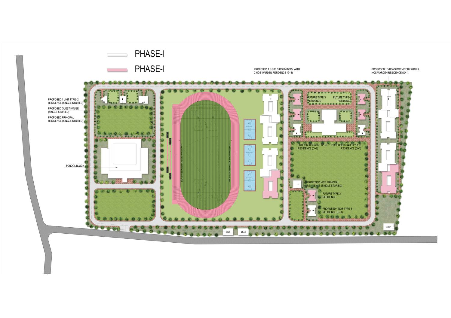
Majuli's alluvial soil, high water table and seasonal floods set the terms for the 33.295-acre Campus. More than 60 per cent of the site stays green. Buildings are oriented north-south to limit heat gain, under pitched roofs with long eaves. A central academic block is joined by separate Hostels, staff quarters, a dining hall and a Guest House along a spine of shaded walkways, and bioswales and open green courts gather the rain.
Noney: terraces on a hillside
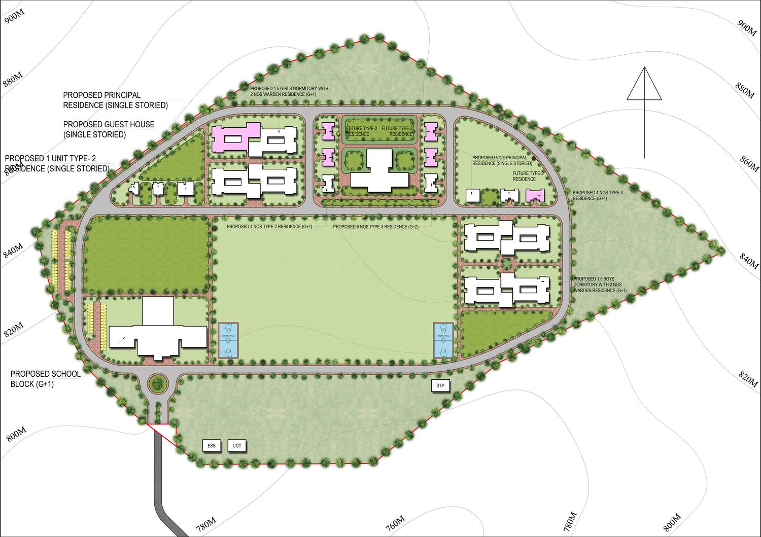
The 30.86-acre site at Noney, on the Imphal-Jiribam corridor, is steep and forested, erodes easily and lies in seismic Zone V. The Campus is terraced. Buildings follow the contours to keep earthwork down, stepped paths climb between levels, drainage runs along the slope and planting binds the ground. Pitched roofs and deep overhangs keep driving rain off the walls.
Side by side, the three plans show how far a site can change a standard programme. In each, sloped roofs shed the rain, deep eaves give shade, and the way water moves across the ground shapes the plan.
Education & Research